UNITE STATES ROAD MAP ATLAS 2024: EXPLORE THE BEAUTY AND DIVERSITY OF THE USA WITH DETAILED MAPS AND TRAVEL TIP
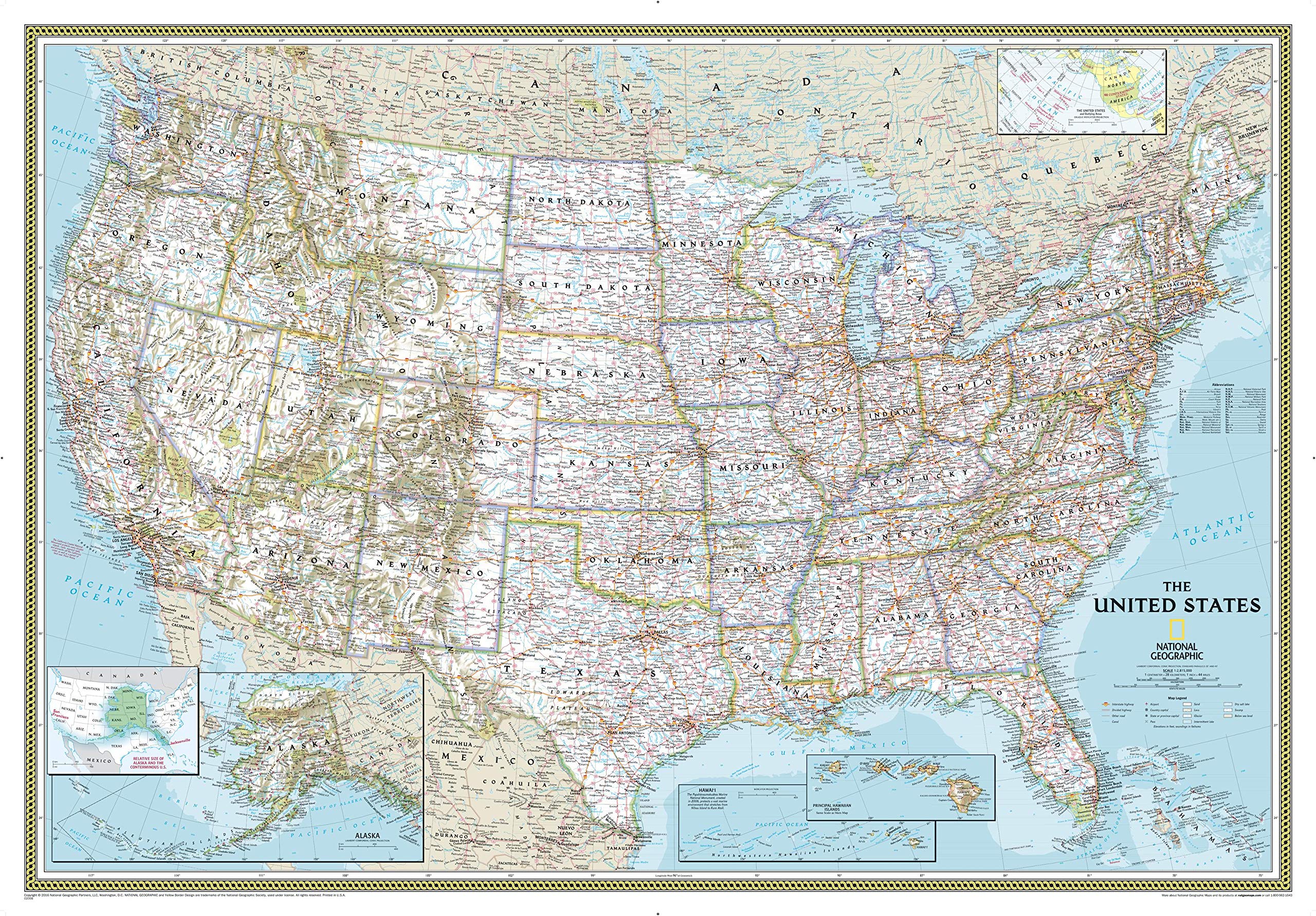
National Geographic Maps: United States Explorer Wall Map - 81 x 51 cm
mapWINGS Map on CANVAS | mapELEFANTE Series MAP of { UNITED STATES of AMERICA (USA) } | Size 2 ft X 1.5 ft | Media – Cotton CANVAS Matte 380 GSM | With Metal eyelets
Rand McNally United States Interstate Fold Map Map – Folded Map, March 1, 2024
Palace Learning Laminated USA Map - 18" x 29" - Wall Chart Map of The United States of America - Made in The USA - Updated (Laminated, 18" x 29")
Map of | country: United States of AMERICA (USA) | on CANVAS with Eyelets | States, Highways & Important Locations (#) | for Edu & Business (Map-Size (L): 2 ft. x 1 ft.)
Palace Learning Laminated USA Map - 18" x 29" - Wall Chart Map of The United States of America - Made in The USA - Updated (Laminated, 18" x 29")
Rand McNally Midsize Easy to Read Road Atlas 2025
Kappa Superior Mapping Company United States Poster Size Wall Map 40 x 28 with Cities (1 Map)
Laminated World Map & US Map Poster Set - 18" x 29" - Wall Chart Maps of the World & United States - Made in the USA (LAMINATED)
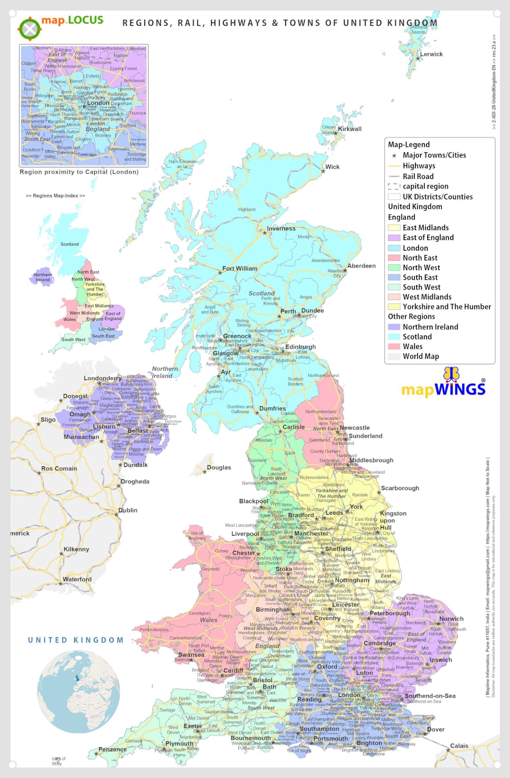
DURABLE MAGNETIC Paper Map of UNITED KINGDOM (UK) & Regions with State, District, Counties Boundaries, Road-Rail, Important Locations with Map-Legend, Size 18 X 11 inches ~ A3 SIZE PORTRAIT
National Geographic Road Atlas 2025: Scenic Drives Edition [United States, Canada, Mexico] (National Geographic Recreation Atlas)
24x36 United States, USA Classic Elite Wall Map Laminated
National Geographic Road Atlas 2025: Adventure Edition [United States, Canada, Mexico] Spiral-bound – June 10, 2024
United State Map Laminated Poster -Double Side Educational Poster For Kids/Adults -18 x 24 inch Waterproof Map For Home Classroom
DURABLE MAGNETIC Paper Map of UNITED STATES of AMERICA (USA) with Core Based Statistical Area (CBSA) classification, Road-Rail, Important Locations with Map-Legend, Size Size 18 X 11 inches ~ A3 SIZE LANDSCAPE
Rand McNally Large Scale Road Atlas 2025 Spiral-bound – Folded Map, March 14, 2024
24x36 United States, USA Classic Elite Wall Map Mural Poster (Paper Folded)
Map of United States of America (USA) | State, Roads & Towns | Size 2 ft. X 1 ft. | Printed on Media - 380 GSM Cotton Canvas Matte, with eyelets | Suitable for Home, Education & Small Business
National Geographic Maps: United States Classic Wall Map - Extra Large - 176 x 122 cm
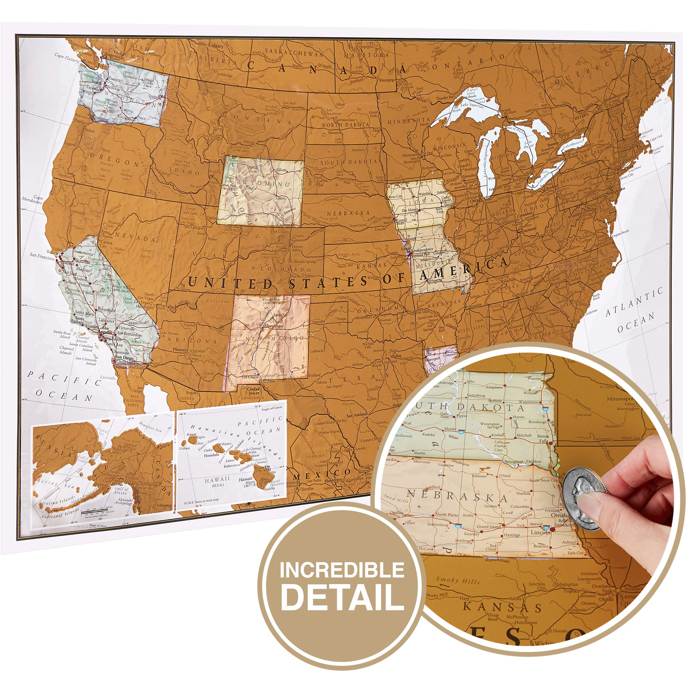
Large Scratch Off Map Of United States 23x16 inch - Hand Drawn Travel USA Map with Accessories - Laminated United States Map - Deluxe Visited States US Map for Home Decor - Cool Traveler Gift Idea
Larsen K12 United States of America Political Map, English Edition, 48 Piece Boxless Tray & Frame Jigsaw Puzzle
National Geographic Maps: United States Contemporary Wall Map - Compact - 59 x 40 cm - Front Lamination
Gadgets Wrap Wall Stickers United States Map Decals for Kid Nursery Children Room Classroom
KappaMapping Company United States Poster Size Wall Map 40 x 28 with Cities (1 Map)
Antique Style USA Map - Wall Chart Map of The United States of America - Made in The USA - Updated (LAMINATED, 18" x 29")
U.S. Map Poster (32 x 50 inches) - Laminated: - a QuickStudy Reference Poster – May 31, 2013
Rand McNally United States Interstate Easy Fold Map
Giant USA Map - Mega Map of the United States of America - US Map Chart - Laminated - 46" x 60" [Blue]
48x78 Huge United States, USA Classic Elite Wall Map Laminated
House of Doolittle Write On/Wipe Off Laminated United States Map 50 x 33 Inch (HOD720)
United States Map with State Flags Poster - Laminated 14x19.5 in. - Educational Poster, USA Map for Kids, Elementary Classroom Decorations, and Teacher Supplies
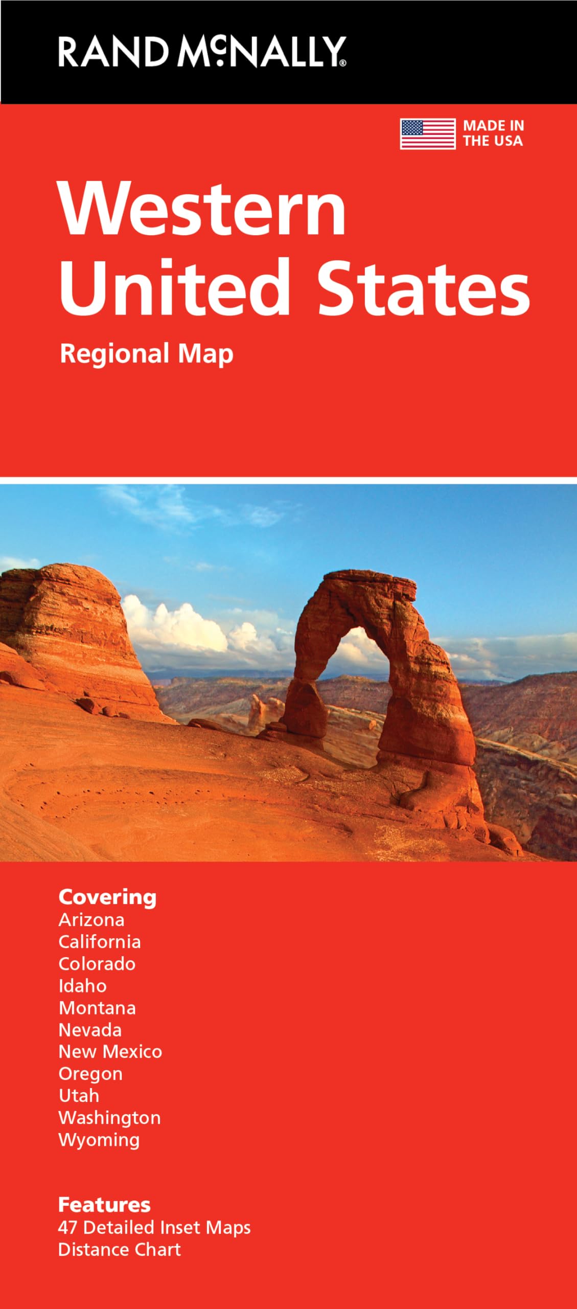
Rand McNally Folded Map: Western United States
United States Interstate Highway Map
Teacher Created ResourcesColorful United States of America Map Chart
USA Map Poster - United States Map Chart [Green/Color]
Rand McNally Folded Map: Eastern United States
United States of America Map Learning Mat
24x36 World and USA Classic Premier 3D Two Wall Map Set (Laminated)
Large Scratch Off Map Of United States 23x16 inch - Hand Drawn Travel USA Map with Accessories - Laminated United States Map - Deluxe Visited States US Map for Home Decor - Cool Traveler Gift Idea
24x36 United States, USA US Executive Wall Map Poster Mural (24x36 LAMINATED)
Rand McNally 2025 Road Atlas & National Park Guide
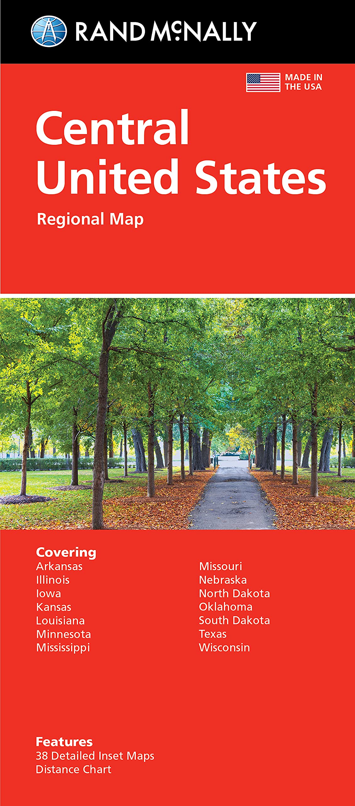
Rand McNally Folded Map: Central United States Map
NOWMAP AquaShield Double-Sided United States, USA Map Waterproof Poster 24x36 - Folded Edition with (Pin Stickers)
2 Pack - Laminated World Map & US Map Poster Set - Wall Chart Map of the World & United States - Made in the USA [Yellow]
Mr. Pen- United States Map for Kids, 14.5”x 24.6”, US Map for Kids Learning, Map of USA, Wall Maps, USA Map Poster, Map of the United States, Kids Map United States, Maps for Kids of The United States
National Geographic: United States Classic Wall Map - Laminated (43.5 x 30.5 inches) (National Geographic Reference Map)
Classic United States USA and World Desk Map, 2-Sided Print, 2-Sided Sealed Lamination, Small Poster Size 11.5 x 17.5 inches (1 Desk Map)
United States USA Wall Map 39.4" x 27.5" State Capitals Cities State & International Boundaries Major Rivers Lakes Timeline
Blank American Maps: To Practice Labeling the 50 States of the United States & Capitals (Blank U.S. Maps)
USA States and State Capitals Map - A3 (30cm x 42cm) Childrens Wall Chart Educational Kids Childs Poster Art Print WallChart
The 50 United States of America Maps & Flags Coloring Book: All USA States Flags, Map with Main City Coloring Activity Book for Kids, Teens & Adult. ... Gift for Student & Travelers Boys & Girls Paperback – 5 Dec. 2020
USA Wall Map for Kids with Illustrations- United States Poster Map for Home or Classroom, (18” x 29” Laminated)
United States, Northeast Map (National Geographic Adventure Map, 3127)
Momo & Nashi United States & World Map Poster for Kids - 2 Pc - 24 x 16 Inch Waterproof USA & Map of the World Poster - for Wall Posters for Learning, Classroom, Education, Back to School Resources
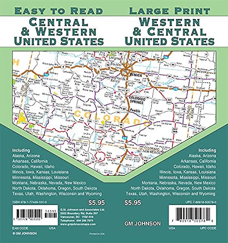
Central & Western United States / Large Print Map
Scratch Off Map of United States by Nexda - Large 24x18 Inches - Colorful Thematic Poster - Individual States Graphics and Flags - Scratching Accessories - Blue and Silver Poster
National Geographic United States Map (folded with flags and facts) (National Geographic Reference Map)
Scratch Off Map of United States + All 63 US National Parks Scratch Off Poster, 85 USA Landmarks, Travel Map Kit, 50 State Photo Wall Adventure Maps, Journal Gifts for Travelers by Bright Standards
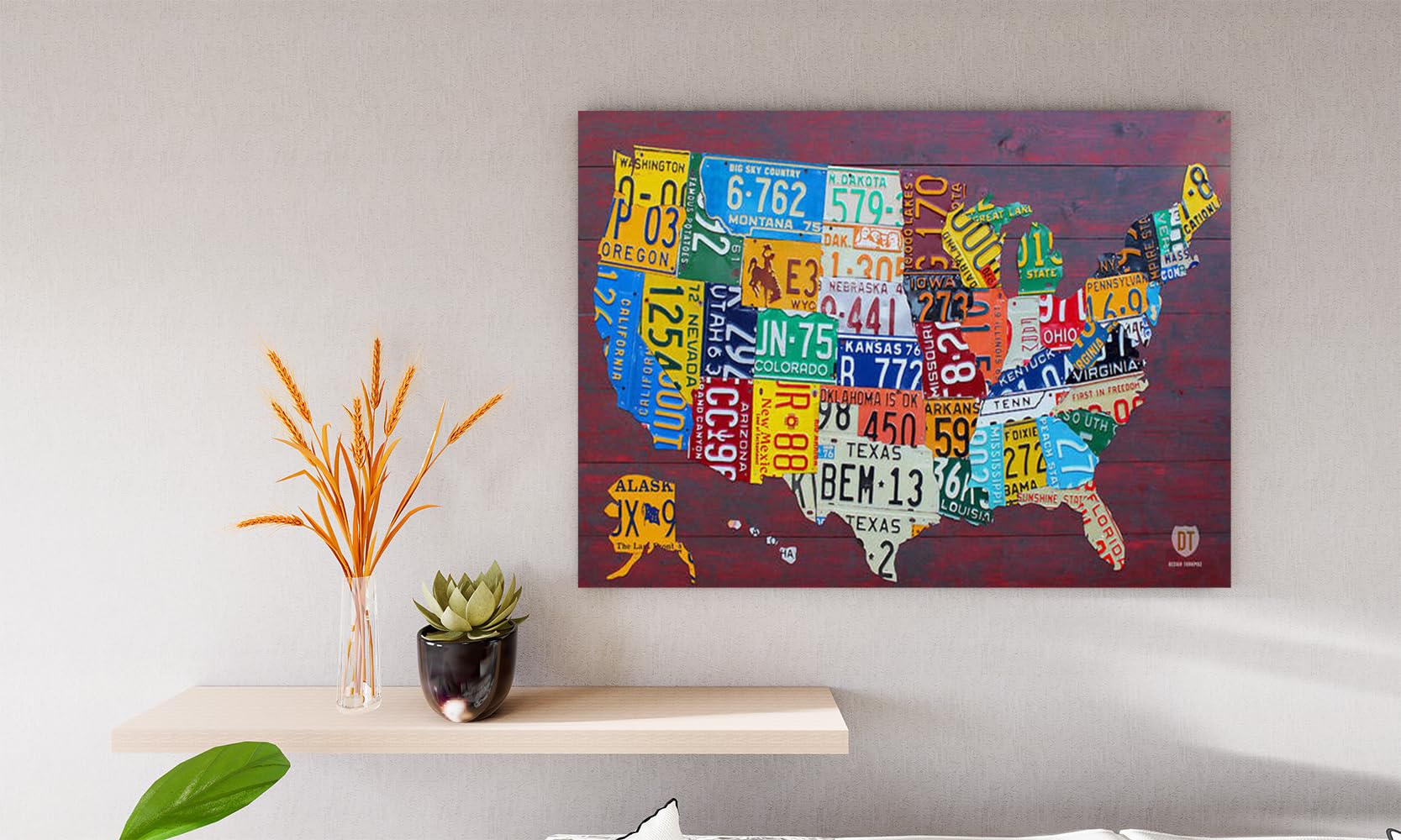
VERRE ART Printed Framed Canvas Painting for Home Decor Office Wall Studio Wall Living Room Decoration (14x10inch White Floater) - License Plate Map Of The United States
Scratch Off Map Of United States, USA State Scratch Sticker, Travel Map Gift Adventure Wall Poster For Kids Adults (States)
USA Map Classic - Front Sheet Lamination - 86.4 (w) x 55.9 (h) cm
32x50 United States Classic Premier Blue Oceans 3D Wall Map Poster (32x50 Laminated)
World Map Poster, United States USA Map, Solar System Posters for Kids - Laminated, Size 14x19.5 in.- Educational Posters for Elementary Classroom Decorations, Teacher Supplies (Maps and Solar)
Rand McNally 2025 Road Atlas (Rand McNally Road Atlases)
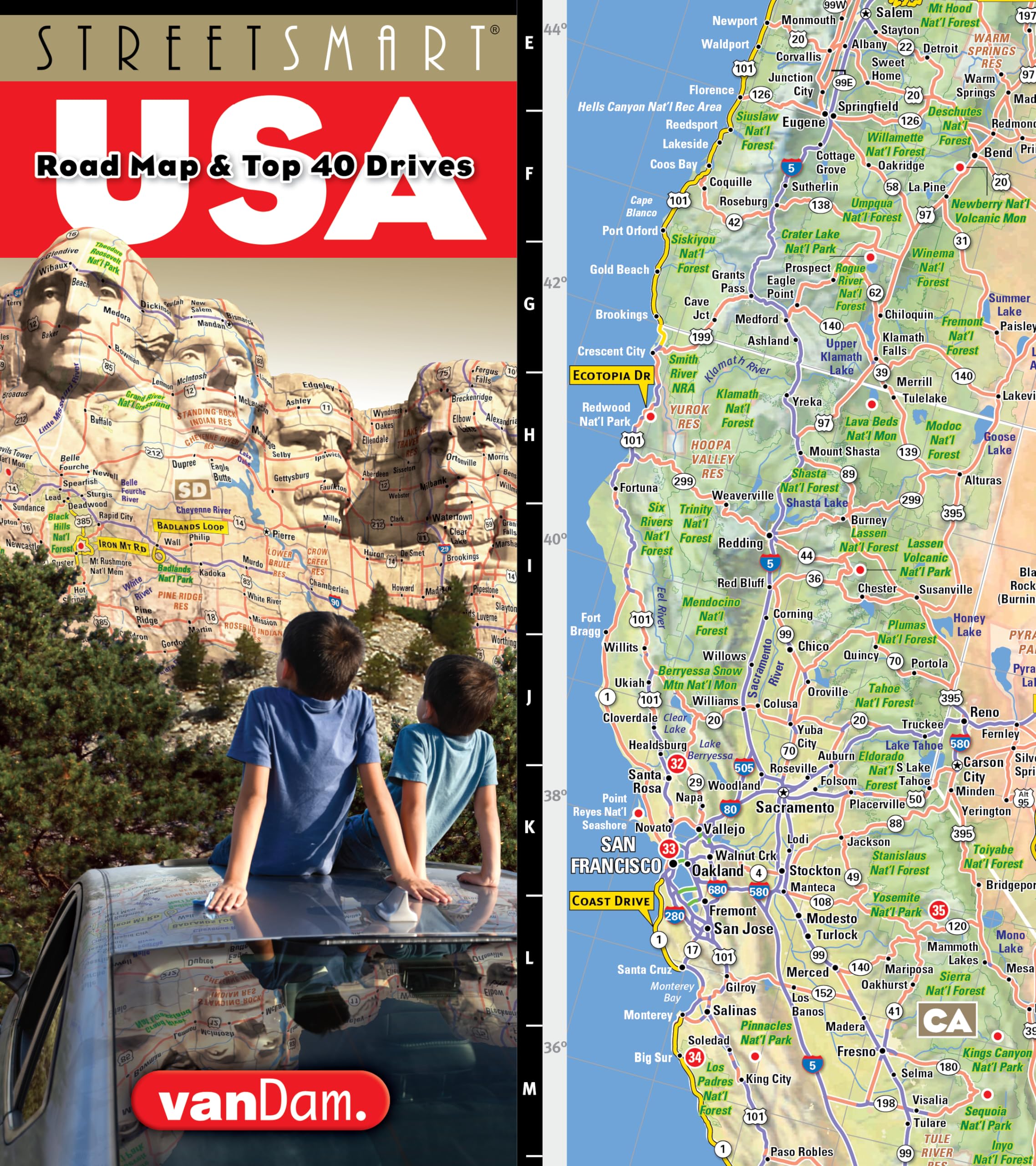
StreetSmart® USA Interstate Road Map by VanDam ― Laminated, planning & travel map of the USA w/all federal, state hwys, attractions & Top 40 Drives (English and Spanish Edition)
24x36 United States, USA Classic Elite Wall Map Mural Poster (Laminated)
UNITED STATES MAP WORKBOOK: EASIEST WAY TO MEMORIZE MAPS: BLANK MAPS OF USA WORKSHEETS, LARGE PRINT 8.5″ X 11″,100 PAGES
UNCLE WU Wall United State Map Poster for Kids -Double Side Learning USA Map -18 x 24 inch Laminated
ArtMinder® Map of the United States - Laser Engraved US Map for Traveling, Alternative to Push Pin Travel State Map Checklist - Adventure USA Map for Wall Gift (Birch Wood, 17x11)
Extra-large USA Laminated Wall Map - 45'' high x 67'' wide
Southeastern USA (National Geographic Guide Map)
The United States Activity and Fact Book: 50 State Maps, Capitals, Animals, Birds, Flowers, Mottos, Cities, Population, Regions
Laminated United States Map Poster - US Map Wall Chart - Made in the USA - [Light Blue] Poster – Poster Calendar, 1 Jan. 2023
United States Executive, Tubed: Wall Maps U.S. (National Geographic Reference Map)
United States, Northeast Adventure Maps: 3127 (National Geographic Adventure Travel Map)
GADGETS WRAP United States Map Flag Wall Decoration Decal Sticker
Scratch Off United States Map - with US National Parks & 50 USA Landmarks - Includes Full Accessories Set & eBook - Premium Scratch Off USA Map for Travelers - Fun United States Travel Map Poster Gift
Rand McNally Folded Map: United States
United States Coloring Book : Dover History Coloring Book, Educational Geography Workbook, 50 States Activity Book, USA Coloring Book
United States Classic, Laminated: Wall Maps U.S. (National Geographic Reference Map)
Safety Magnets Map of United States for Kids - US Map with Capitals - American Map Poster - 50 States Map ,Laminated- 17 x 22 inches multicolor
FINGERINSPIRE 4 Pcs USA 50 States Stencil 11.8x11.8 inch United States Map Stencil Template Sets Plastic United States Map Outline Stencils Reusable DIY Home Decor Stencil for Crafts Decorations
Scratch USA Travel Sized map - Scratch Off Places You Travel United States map - America - Detailed Cartography - US States - National Parks - 17 (w) x 11 (h) inches
TRAVELISIMO Scratch Off Map of United States, 12x17 inches United States Map for Traveling, Scratch Map Set with 25 Unique Accessories, Colorful Travel Map Scratch Off, Travel Map for Couples
Imagimake Mapology India with State Capitals - Educational Toy and Learning Aid for Boys and Girls - India Map Puzzle - Jigsaw Puzzle, 25 Pieces, Kids
Historical Atlas of the United States: With Original Maps
Stencilia United States map Outline Stencil for Craft Painting, Scrapbooking | Small Size 6x6 inch Reusable Stencils for Painting on Wall, Fabric, Wood, and DIY Art Projects
USA Map Poster - United States Map Chart [Purple] (Laminated, 18" x 29")
24x36 United States, USA, US Classic Elite Wall Map Mural Poster Folded
Rand McNally Easy to Fold: United States Laminated Map
The United States Activity and Fact Book: 50 State Maps, Capitals, Animals, Birds, Flowers, Mottos, Cities, Population, Regions
Map of | country: UNITED KINGDOM (UK) | on CANVAS with Eyelets | States-Regions, Highways & Important Locations (#) | for Edu & Business (Map-Size (XL): 2 ft. x 1.5 ft.)
Map of United Kingdom (UK) | State, Roads & Towns | Size 2 ft. X 1 ft. | Printed on Media - 380 GSM Cotton Canvas Matte, with eyelets | Suitable for Home, Education & Small Business
24x36 United States, USA US Executive Wall Map Poster Mural Laminated
United States Map Book: Environmental Atlas (Mapbook Atlas Series)
VERRE ART Printed Framed Canvas Painting for Home Decor Office Wall Studio Wall Living Room Decoration (14x10inch Wrapped) - License Plate Map Of The United States
Build a Giant Poster Coloring Book--United States Map (Dover Build a Poster Coloring Book)
FINGERINSPIRE United States Travel Maps Stencil 11.8x11.8 inch United States Outline Map Stencil Plastic Planes Cars Parachutes Hot Air Balloons Patterns Stencil Reusable DIY Craft Stencils for Decor


![National Geographic Road Atlas 2025: Scenic Drives Edition [United States, Canada, Mexico] (National Geographic Recreation Atlas)](https://m.media-amazon.com/images/I/814R4OsGtCL.jpg)

![National Geographic Road Atlas 2025: Adventure Edition [United States, Canada, Mexico] Spiral-bound – June 10, 2024](https://m.media-amazon.com/images/I/81rRihqWqgL.jpg)


![Giant USA Map - Mega Map of the United States of America - US Map Chart - Laminated - 46" x 60" [Blue]](https://m.media-amazon.com/images/W/MEDIAX_792452-T2/images/I/91AqF85f2WL.jpg)


![USA Map Poster - United States Map Chart [Green/Color]](https://m.media-amazon.com/images/I/91hlqXJIonS.jpg)


![2 Pack - Laminated World Map & US Map Poster Set - Wall Chart Map of the World & United States - Made in the USA [Yellow]](https://m.media-amazon.com/images/I/91d58tGhj2L.jpg)


![Laminated United States Map Poster - US Map Wall Chart - Made in the USA - [Light Blue] Poster – Poster Calendar, 1 Jan. 2023](https://m.media-amazon.com/images/I/91RF81NKshL.jpg)


![USA Map Poster - United States Map Chart [Purple] (Laminated, 18" x 29")](https://m.media-amazon.com/images/I/91iSwmfTK1S.jpg)